Road Routes
Some popular road routes around the area. Improvisation encouraged.
These are just a few of the classic routes in the area, but by no means a definitive list. There is a nearly endless supply of quiet country roads out there. So draw yourself a map, get out there, and give it a shot. Soon you’ll know why for decades Lafayette County has been a popular location for team training camps.
VDGF Route - 20 miles
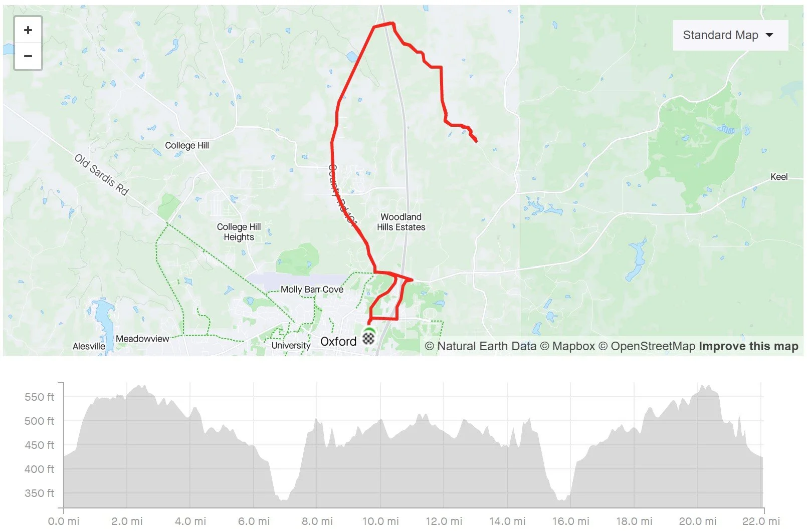
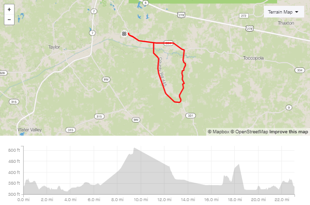
Clocking in at 22.4 miles, this route extends out to Smith’s Chapel, just outside the Holly Springs National Forest. This route involves approximately 1,150 feet of elevation gain.
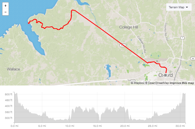
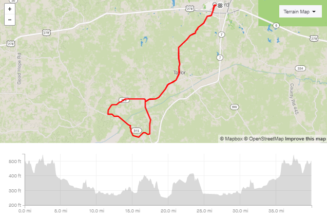
VDGF Route - 45 miles

This route measures up to around 46.75 miles and 2,300 feet of elevation gain. This route will continue beyond Smith’s Chapel, traversing up to Abbeville, over to Hurricane Landing, and then taking College Hill Road back into town.
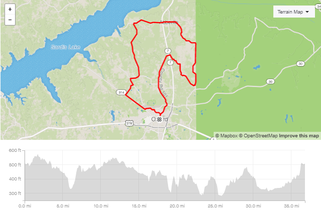
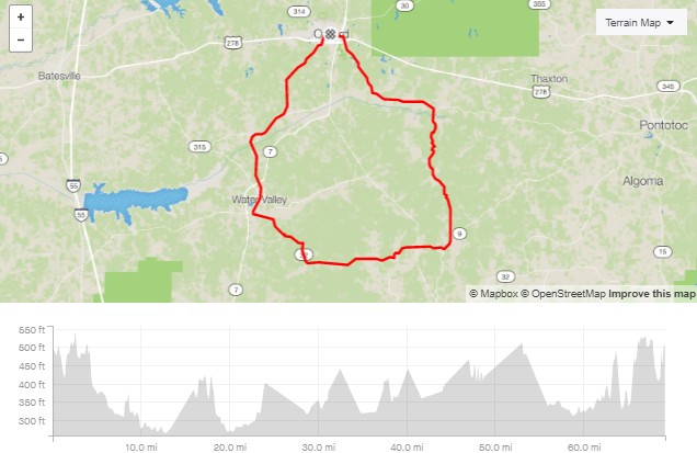
VDGF Route - 70 Miles

Around 71.5 miles, this longer ride will cover 3,425 feet of elevation adding turn-around extensions to Coontown Crossing and Clear Creek Landing.
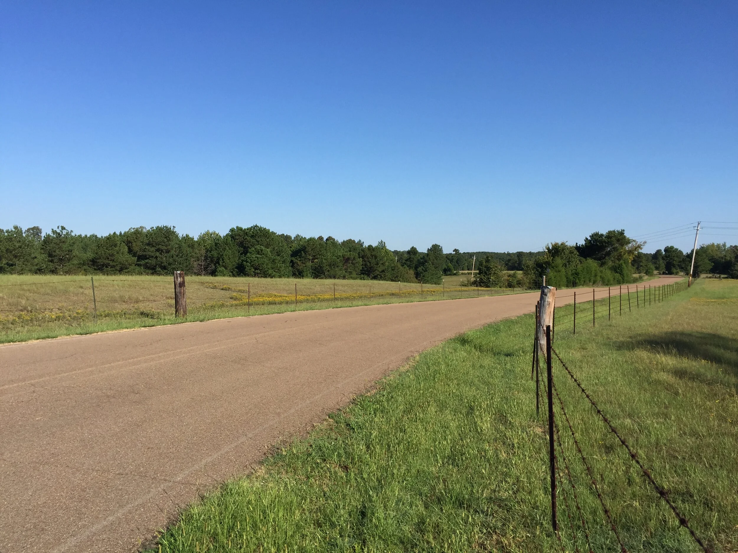
Clear Creek
The classic. The first ride anyone ever does here. Just an out and back to the lake with some longer flats and lots of rollers too.
Abbeville
Another classic and a great ride if out-and-backs aren’t your jam. The scenery on this route is fantastic and it has some really good hills to get your legs nice and hotted up.
You will learn to love or loathe, but never regret, Pipeline.
Water Valley
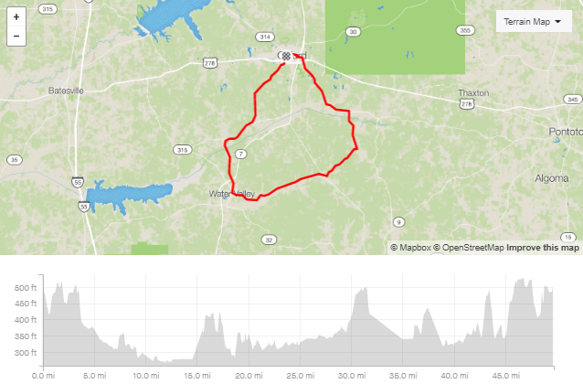
The Water Valley route is the OG of OG routes around here. It is the quintessential training loop, with every surface, condition and attribute you could need. Thanks to population growth, the iconic (for here) Alps at the end are best avoided during busier times of day. It’s encouraged to take either S. Lamar or Bell River Farms Rd. back into town. Look at Strava’s heatmaps for alternative endings.
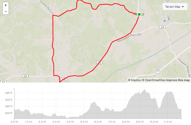
B-Team Yocona Route
This is the traditional B-Team weekday route. It starts from more or less the Oxford Treehouse Gallery and wanders into and out of Tula, MS. Beautiful, quiet roads. A real nice ride.
Race Loop
Riding from Taylor is probably the best place to start and end a ride given there is ample parking, no traffic, a great coffee shop and some of the best food in town. Directly west or south of this loop are endless roads that can be incorporated into rides for days. Get creative.
https://www.strava.com/routes/24849729 - CW or CCW
3 Landings
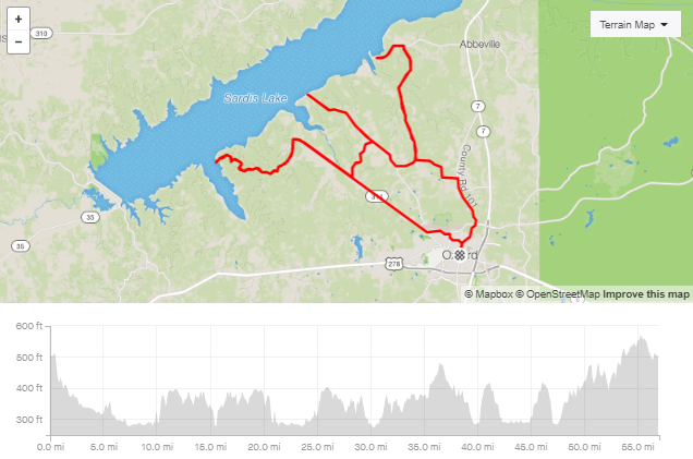
Enjoy the view of Sardis lake from 3 different landings: Hurrican Landing (upper), Coontown Crossing (middle), and Clear Creek Landing (lower).
Prophet Bridge
A 40 mile classic for when you want to get some miles in, but you’re totally noncommittal. For some reason, this is psychologically acceptable as a rain-loop.
https://www.strava.com/routes/1379418 - CCW or CW
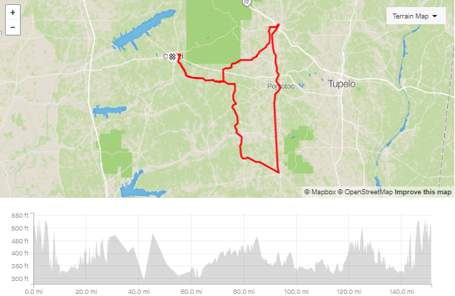
Banner
Banner is synonymous with a BIG day. This is the de facto Banner from Oxford loop, but you are more than welcome to a) start from Taylor and b) expand the route on the southwest and southeast corners of it. If you’re doing this route, you aren’t afraid of miles, so have a little fun modifying it. There’s lots around Enid, Bruce and Algoma.
The Big Ride
This is here, just because it was actually done a couple of times. The BIGGEST day. Ride from Oxford, all the way to the southernmost tip of the Tanglefoot Trail, take on the entire Tanglefoot, then wonder back home, thinking about burritos.
If riding to Sardis lake is getting boring to you, try this route and venture out to Enid lake from Oxford, MS. This route has decent distance and elevation gain.
If you really like lakes around Oxford, MS, try this Hell Yeah Dam Ride (HYDR) century route. You will ride through 2 scenic dams, 3 counties, and will have these 100 miles to remember for life. Caution: There is a 1.5-mile gravel section on CR 317.
This route convers south east of Oxford and Abbeville. It has a little bit of everything including Ole Miss campus, bike lane on S Lamar. After Abbeville, feel free to ride out to Hurricane Landing on CR 108, you won’t be disappointed.